ISO XML
How to retrieve data from your traktor or combiner etc. are different on each device. This guide will help you inserting the Taskdata (+it associated binary files) in to the GeoDataFarm plugin.
If you are curious what the any of the tags or values in the .xml files stands for you can checkout: https://github.com/axelande/pyAgriculture11783/tree/main/schemas
Create a new field based on the ISO XML files
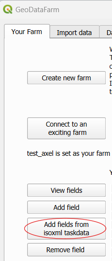
The ISO XML files often contains some spatial data. Some Taskdata.xml have “PFD” tag which then contains the layout of the field directly, others have them in a GRD (grid format), other have them in the logged data. Regardless in GeoDataFarm you can add the fields from them. On the “Your Farm” tab go to “Add fields from ISOXML Taskdata”.
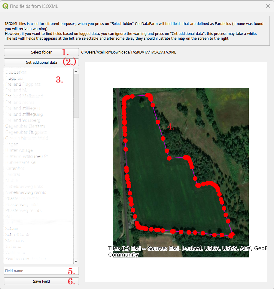
- Select the folder and the location where the Taskdata.xml is located.
- If you have the parfield you will get the fields directly listed in the menu, else you have to press “Get additional data”.
- Select the field you want to add.
- Edit the field boundary by dragging the red points.
- Type the name of the field.
- Press save field.
Retrieve the actual data from the ISOXML files
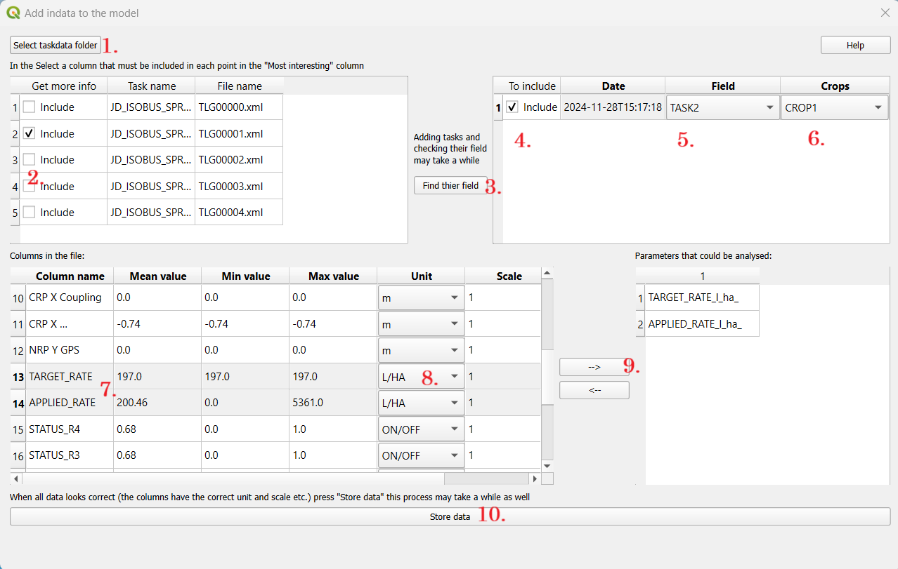
- Press on “Select taskdata folder” to get a dialog and select the folder that contains the Taskdata and TLG files. (This will fill the first table to the left).
- You will now get a list that contains one row for each TLG xml/bin file. If you don’t want to include all deselect the “include”.
- Press “Find their field”. This process takes some time, since all data (in the selected tasks) in taskdata folder are being “decrypted”. (This will fill the second top table to the right and the first bottom table to the left).
- If you don’t want to include the task (when adding the data) deselect this row
- Make sure that the Field is correct, else change to the correct field.
- Select crop.
- This is a list with all the columns in the TLG files. Go through the list and select/change the unit of all columns.
- When the unit is changed the “Scale” will also change, this can also be edit manually.
- Select the rows with the most interesting data (e.g. the yield and moister) and press on “>” to get them in the parameter list.
- Press Store data to save the data. This will take a while.
If you want to combine two tasks you can do that with the process illustrated here: Edit data set 2.
Other ISO XML application
There are so many different application where ISO XML files are of interest, maybe you want to create guidens files or something else. This is (so far) not implemented in GeoDataFarm, I’ve started with a different open source project: https://github.com/axelande/pyAgriculture11783 please let me know if you is interested in more applications in GeoDataFarm!